- Teacher: Greger Lindeberg
- Teacher: Zofia Pawlak
- Teacher: Sara Wiman
- Teacher: Krzysztof Zych
EO4GEO Project work
This report is a part of the training actions within the Smart cities subsector. The report addresses the problem with flooding in urban areas connected to short-term, intense rainfall events, or cloudbursts. This report shows how satellite derivatives and Copernicus data can be used to model the impact of these events.
Organizers: Geografiska Informationsbyrån (GiB)
Teacher: Greger Lindeberg, GIB
Student: Jo Santiago
Language: English

- Teacher: Greger Lindeberg
- Teacher: Zofia Pawlak
- Teacher: Sara Wiman
- Teacher: Krzysztof Zych

- Teacher: Greger Lindeberg
- Teacher: Zofia Pawlak
- Teacher: Sara Wiman
- Teacher: Krzysztof Zych
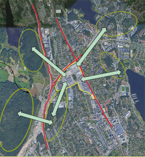
The urban green infrastructure provides a number of important ecosystem services to city habitants. The webinar consists of a theoretical background on green infrastructure and ecosystem services, but also real-world cases exemplified by an extensive urban development planned north of Stockholm metropolitan area.
Participants will learn more about the use of EO and GIS tools, urban green infrastructure and ecosystem services.
The webinar is mainly non-technical and targets planners on different levels in cities or municipalities but also Climate adaption coordinators, GIS technicians, researchers and ecologists.
- Teacher: Greger Lindeberg
- Teacher: Zofia Pawlak
- Teacher: Sara Wiman
- Teacher: Krzysztof Zych
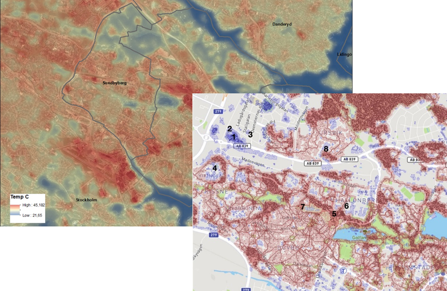
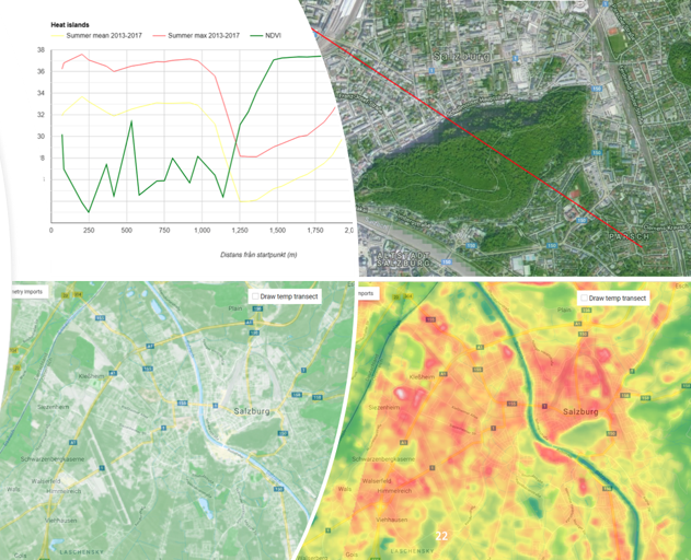
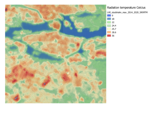
This is a webinar for city planners about Urban Heat Islands and the importance of their identification in a spatial planning context. The webinar introduces the EO surface temperature maps, with their potential and their limitations.
This webinar is developed within the Smart cities task in the EO4GEO project. The webinar addresses the issue of urban heat and urban heat islands, and more specifically how to use EO-derived surface temperature maps to identify areas prone to heat stress in the urban environment. It presents a theoretical background on urban heat and how to obtain information from satellite sensors.
Together with this, a real-world case is presented from the city of Stockholm, presenting the usage of surface temperature maps for the identification of temperature hot-spots within the city, along with spatial planning information.
Participants will learn more about EO, urban heat, surface temperature, mitigation of heat in a spatial planning context.
The webinar is mainly non-technical and targets planners on different levels in cities or municipalities, Climate adaption coordinators, GIS technicians, researchers, and ecologists.
- Teacher: Greger Lindeberg
- Teacher: Zofia Pawlak
- Teacher: Sara Wiman
- Teacher: Krzysztof Zych